-
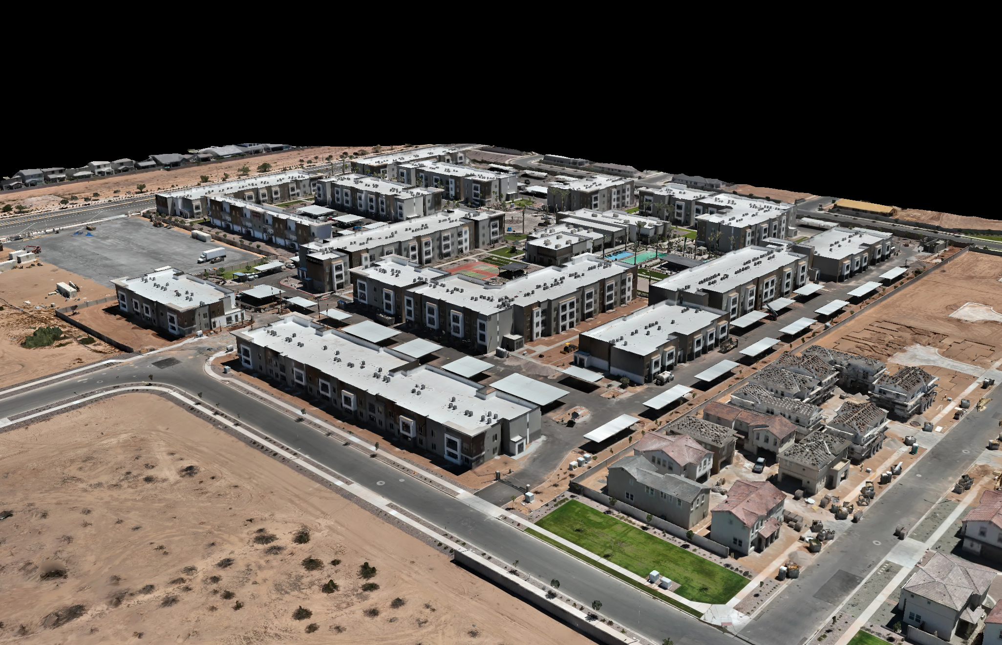
Aerial Mapping and Photogrammetry
Harnessing drone-captured imagery and advanced photogrammetry software, we produce high-resolution orthomosaics, 3D textured models, and GIS/CAD-ready outputs. Ideal for construction planning, site surveys, and engineering workflows, our mapping solutions deliver precise, actionable geospatial data.
-
Inspections and Progress Monitoring
Through scheduled aerial flyovers, we document construction milestones and site changes over time, providing visual progress reports and comparison overlays. We also conduct targeted visual inspections—capturing high-resolution imagery of critical assets, such as rooftops, infrastructure, and equipment, to identify issues early.

-
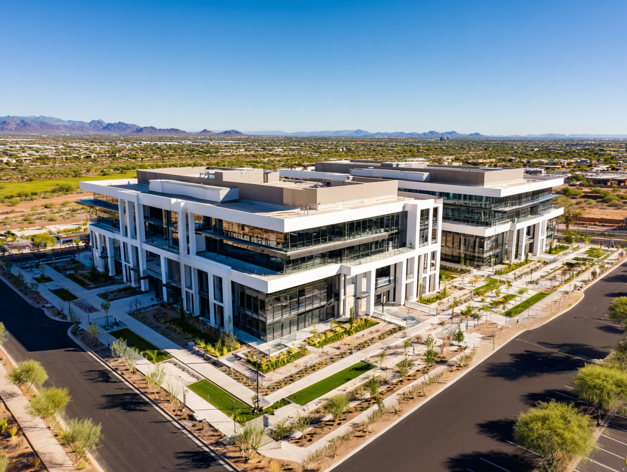
Aerial Photography and Videography
We create compelling aerial imagery and cinematic video content tailored for marketing, real estate listings, stakeholder presentations, and event coverage. Our visuals highlight property layout, access, and aesthetics—perfect for showcasing your site’s best angles and boosting engagement.
-
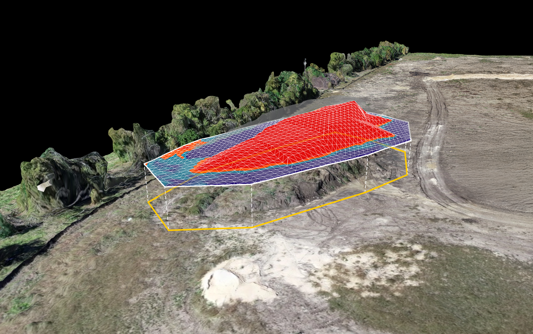
Volumetric Analysis (Cut/Fill)
Using precision drone data, we deliver fast and accurate volumetric assessments—stockpile measurements, cut‑and‑fill comparisons, and earthwork analyses—to ensure efficient material management and regulatory compliance. Clients save time and reduce costs with clear, data-backed reporting.